


Infra
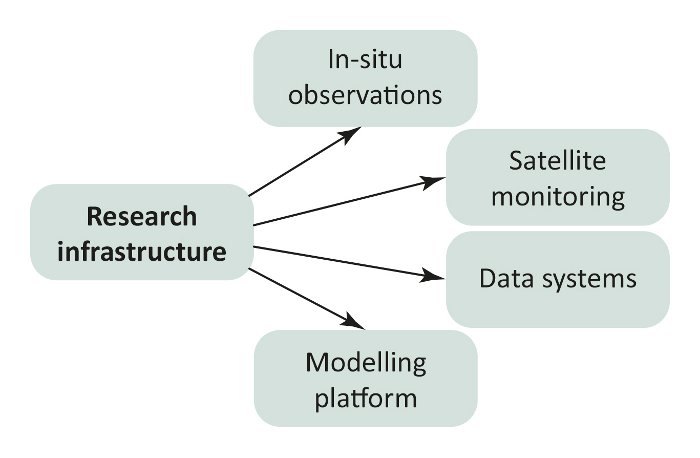
Focus-2: Aims of PEEX infrastructures:
- To establish and sustain long-term, continuous and comprehensive ground-based, airborne and seaborne research infrastructures together with satellite data (observation component).
- To develop the new data sets and archives with continuous, comprehensive data flows in a joint manner (data component).
- To implement the validated and harmonized data products in models of appropriate spatial and temporal scales and topical focus (modeling component).
Solutions to the interconnected global environmental problems can be provided only by a harmonized and holistic comprehensive observational approach utilizing all available modeling tools representing different spatial and temporal scales. On the other hand all tools including models and observational/experimental devices need to be developed further in order to answer research questions and solve challenges. The PEEX approach uses research methods including both experimental and modeling tools, and ranging from nanometer and sub-second observations and process studies to global and decadal scale measurement activities, datasets and model simulations. The vision of the PEEX infrastructure is to provide comprehensive, continuous and reliable harmonized data products for forecasting services, and for the science community (PEEX Science Plan).
The PEEX research infrastructure aims to establish a long-term comprehensive field station network in the region covering Europe particularly Scandinavia and Baltic countries, Russia and China. The integrated measurements of the hierarchical station network are designed to increase our quantitative process understanding of the land-atmosphere-ocean continuum, and of the impact of anthropogenic activities on the (eco)systems. In the first phase, the land-based station network will be based on existing infrastructure consisting of (i) standard stations including weather stations, (ii) flux (FLUXNET) stations, (iii) flagship stations and (iv) satellite receiving stations. The strategic focus is to ensure the long-term continuation of advanced measurements of aerosols, clouds, GHGs and trace gases in the northern Eurasian area. The preliminary concept of a hierarchical network for aquatic observations in the surrounding seas consist of simple buoys deployed on sea ice in the open sea, sophisticated buoys, research vessels, flagship stations, manned drifting ice stations, and permanent coastal and archipelago stations (PEEX Science Plan).