Station for Measuring Ecosystem-Atmosphere Relations
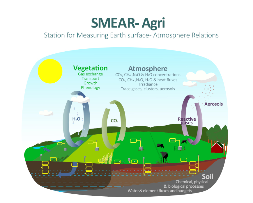
The SMEAR-Agri Viikki & Haltiala measurement stations consists of two cultivated field sites located in Helsinki, which are the first comprehensive agricultural measurement stations in Finland studying the impacts of agricultural land use on climate and waterways with continuous year-round measurements (Fig. 1).
The stations are part of SMEAR station network and INAR RI Agriculture infrastructures, and they are maintained together by the University of Helsinki (Faculty of Agriculture and Forestry) and INAR (Institute for atmospheric and Earth system research, University of Helsinki). The first SMEAR-Agri measurement station was established in 2020 on a clay loam soil with cereal cultivation and is located at Haltiala farm owned by the City of Helsinki. The second measurement station was established in 2021 on a clay soil at Viikki Research Farm, operated by the University of Helsinki, and the site has a rotation of perennial grass with one year of cereal cultivation in between. Professor Mari Pihlatie (Soil and Environmental Science, Faculty of Agriculture and Forestry) and professor Annalea Lohila (INAR and Finnish Meteorological Institute) lead the research activities of the SMEAR-Agri stations.
What SMEAR-Agri stations provide?
- Continuous H2O, CO2, CH4 (and N2O in Viikki) flux measurements, carbon balance, soil carbon and nutrient stocks, and losses of carbon and nutrients with discharge water
- Data on long-term effects of changing weather conditions and climate-smart cultivation practices on GHG fluxes, soil carbon and nutrient stocks and water-induced losses
- A research platform to study climate and air quality impacts of northern agriculture
- Infrastructure and data on soil, crop, meteorological and GHG exchange for science projects and collaboration